
Snow shoe hiking tour to the Bel Colle/Schönbichl

Bruneck and surroundings
Add to favourites
Category
Difficulty
Intermediate
Duration
3:30
in hours
Distance
4.9
in km
Suggested period
Jan
Feb
Mar
Apr
May
Jun
Jul
Aug
Sep
Oct
Nov
Dec

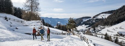
A beautiful snowshoe hike with moderate difficulty and beautiful view on the Dolomites, as well as on the main Alpine ridge and the Rieserferner peaks.

Before you start for a snowshoe hike you should always consult the avalanche and weather report!

Route data
Intermediate
Distance
4,9 km
Duration
3 h 30 min
Ascent
967 m
Decent
1 m
Physical condition
Scenary
Highest point
2.435 m
Lowest point
1.468 m
Directions
The starting point is in Montassilone/Tesselberg, a hamlet of Gais - accessible by car via Uttenheim/Villa Ottone or Percha/Perca. Walk along a forest path from the village to Tesselberger hut and from there continue uphill in a southeasterly direction to the summit of Schönbichl/Bel Colle (path no. 7). Tour orientation: West; highest point: 2452 m; hiking time from Montassilone to the peak: about 2 hours.
How to get there

Tesselberg/Montassilone is only accessible by car. Alternatively, you can take bus no. 450 to Gais, stop Dorf/Paese, and then walk up to Tesselberg/Montassilone (approx. 1h walking time).

You might be interested in
Discover related tours
Bruneck and surroundings
Snow shoe hiking tour to the Plattner Spitze
Distance 5,7 km
Duration 4 h 30 min
Ascent 839 m
Decent 839 m
Bruneck and surroundings
Snow shoes walking at the Sambock
Distance 4,3 km
Duration 4 h 00 min
Ascent 887 m
Decent 887 m
Bruneck and surroundings
Snow shoe hiking tour at the Putzenhöe
Distance 11,3 km
Duration 5 h 30 min
Ascent 980 m
Decent 980 m
Snowshoes hike | © Harald Wisthaler, Bruneck Kronplatz Tourismus
Intermediate
Add to favourites
Bruneck and surroundings
Snowshoeing on Cima Lasta/Astjoch
Distance 10,2 km
Duration 4 h 00 min
Ascent 713 m
Decent 713 m
Bruneck and surroundings
Snow shoes walking at the Cima Lasta
Distance 10,5 km
Duration 3 h 07 min
Ascent 698 m
Decent 697 m