Pfalzen / Falzes – Irenberg

Bruneck and surroundings
Add to favourites
Category
Difficulty
Easy
Duration
2:00
in hours
Distance
4.9
in km
Suggested period
Jan
Feb
Mar
Apr
May
Jun
Jul
Aug
Sep
Oct
Nov
Dec
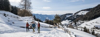
Easy walk, suitable for families - in summer also with stroller - from the sports area in Pfalzen/Falzes to Irenberg.
Route data
Easy
Distance
4,9 km
Duration
2 h 00 min
Ascent
126 m
Decent
126 m
Physical condition
Scenary
Highest point
1.054 m
Lowest point
936 m
Suggestions
As the hiking trails can be icy, it is advisable to use microspikes.
Directions
The starting point is the sports zone in Pfalzen/Falzes. Hike up the Irenberg road for a short distance and then follow trail no. 6B on the right and through the forest, until you reach the Irenberg inn. Walk back the same way or go northwards to the edge of the forest, then take forest path no. 6 to the "Issinger Weiher" pond and finally, following the signpost "Pfalzen", return to the sports area.
How to get there
Public transport from Mobility Center Bruneck/Brunico:
With the bus 421 or 422 to Pfalzen/Falzes, bus stop Town Hall, and after 5-10 minutes walk to the sports area.
You might be interested in
Discover related tours
Wandern | © (c) Manuel Kottersteger, Olang
Intermediate
Add to favourites
Bruneck and surroundings
Geiselsberg - Bruneck
Distance 11,5 km
Duration 3 h 08 min
Ascent 227 m
Decent 741 m
Bruneck and surroundings
Hike through the "LandArt" trail
Distance 2,3 km
Duration 37 min
Ascent 36 m
Decent 49 m
Bruneck and surroundings
Panoramic path Concordia 360°
Distance 2,4 km
Duration 40 min
Ascent 75 m
Decent 75 m
Bruneck and surroundings
Geiselsberg - Kronplatz
Distance 5,8 km
Duration 3 h 00 min
Ascent 957 m
Decent 2 m
Bruneck and surroundings
From Niederolang to the Kronplatz
Distance 19,9 km
Duration 6 h 39 min
Ascent 1.340 m
Decent 1.350 m
Bruneck and surroundings
Saint Valentine church
Distance 2,6 km
Duration 1 h 00 min
Ascent 26 m
Decent 26 m