Kaiserwarte

Bruneck and surroundings
Add to favourites
Category
Difficulty
Easy
Duration
0:44
in hours
Distance
2.1
in km
Suggested period
Jan
Feb
Mar
Apr
May
Jun
Jul
Aug
Sep
Oct
Nov
Dec

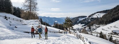
Easy walk from Bruneck/Brunico to "Kaiserwarte" and Reischach/Riscone.

Around 1903, on the highest point of "Kühbergl/Monte Spalliera", a 18 meters high observation tower was built, which allowed the Emperor Franz Joseph I to observe the artillery movements in Brunico and surroundings. This tower and the hill were named "Kaiserwarte". Later the tower became a popular scenic spot, but over the years it suffered natural damages and in 1950 it had to be removed for safety reasons. Currently a small stone column can be seen where once the tower stood.

Route data
Easy
Distance
2,1 km
Duration
44 min
Ascent
166 m
Decent
0 m
Physical condition
Scenary
Highest point
1.007 m
Lowest point
838 m
Suggestions
As the hiking trails can be icy, it is advisable to use microspikes.
Directions

The walk starts in Bruneck/Brunico (835 m) at the crossroad with the street in direction Reischach/Riscone. The wide hiking paths no. 20 and 21 conduct pleasantly uphill to the "Kaiserwarte", the highest point of the hill "Kühbergl", and to Reischach (958 m).

You might be interested in
Discover related tours
Panoramic trail Pfalzen / Falzes | © Harald Wisthaler, Bruneck Kronplatz Tourismus
Intermediate
Add to favourites
Bruneck and surroundings
Panoramic trail Pfalzen / Falzes
Distance 5,2 km
Duration 2 h 00 min
Ascent 189 m
Decent 189 m
Aschbach Alm hut and Redensberg Alm hut | © Schuster Barbara, Tourismusverein Antholzertal
Intermediate
Add to favourites
Bruneck and surroundings
Aschbach Alm hut and Redensberg Alm hut (not managed)
Distance 3,4 km
Duration 1 h 52 min
Ascent 578 m
Decent 7 m
Status
closed
Bruneck and surroundings
Lanebach
Distance 3,6 km
Duration 2 h 05 min
Ascent 662 m
Decent 0 m
Status
closed
Bruneck and surroundings
Panoramic path Concordia 360°
Distance 2,4 km
Duration 40 min
Ascent 75 m
Decent 75 m
Status
closed
Bruneck and surroundings
Hiking Trail Haidenberg
Distance 2,0 km
Duration 1 h 00 min
Ascent 343 m
Decent 343 m
picnic area | © Tourismusverein Kiens, Kiens
Intermediate
Add to favourites
Bruneck and surroundings
Culture and landscapes
Distance 12,1 km
Duration 3 h 27 min
Ascent 341 m
Decent 341 m