
Alpine tour from Reischach/Riscone to the Kronplatz/Plan de Corones summit

Bruneck and surroundings
Add to favourites
Category
Difficulty
Difficult
Duration
4:05
in hours
Distance
6.2
in km
Status
closed
Suggested period
Jan
Feb
Mar
Apr
May
Jun
Jul
Aug
Sep
Oct
Nov
Dec

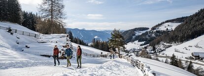
The hike from Reischach/Riscone to Kronplatz/Plan de Corones is demanding and recommended for those who are well-trained.

Route data
Difficult
Distance
6,2 km
Duration
4 h 05 min
Ascent
1.332 m
Decent
11 m
Physical condition
Scenary
Highest point
2.274 m
Lowest point
948 m
Directions

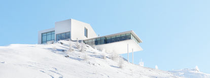
From the car parking at the valley station head towards the "Steak House Hardimitzn" (restaurant) and continue up to the first trail (n. 6 - path AVS). The trail is well marked, through the woods, partly on a dirt road, partly on a path, until it crosses a forest road just before the mid-station. Turn right and continue for 200 meters along the road until you come to a turn. The AVS trail continues left through the woods and takes to the meadow "Seewiese" (small lake). Cross the slope and go straight on until you reach the forest road, which you cross and then hike upwards through the forest until you reach the open terrain. Always following the signposted path, the tour passes below the LUMEN Museum and finally leads up to the Kronplatz/Plan de Corones summit.

How to get there

Public Transports from Mobility Center Bruneck/Brunico:
With the bus no. 420.1 to Reischach/Riscone - bus stop Gondelbahn Kronplatz/Cabinovia Plan de Corones.

You might be interested in
Discover related tours
Lake di Plata | © TV Kiens, Kiens
Intermediate
Add to favourites
Bruneck and surroundings
Peaks and lakes on the Pfunderer Höhenweg
Distance 11,3 km
Duration 4 h 01 min
Ascent 956 m
Decent 956 m
Status
closed
Schönbichl | © Thomas Conti, Bruneck Kronplatz Tourismus
Intermediate
Add to favourites
Bruneck and surroundings
Alpine tour on the summit of the “Schönbichl” in Tesselberg/Montassilone
Distance 11,5 km
Duration 4 h 06 min
Ascent 995 m
Decent 995 m
Bruneck and surroundings
Alpine tour on the summit “Bloßberg” in Uttenheim/Villa Ottone
Distance 6,5 km
Duration 5 h 00 min
Ascent 1.780 m
Decent 1.780 m
Status
closed
Geige-Kor-Schönbichl | © @Conti Thomas, Bruneck Kronplatz Tourismus
Intermediate
Add to favourites
Bruneck and surroundings
Circular hiking tour of the summits Geige-Kor-Schönbichl
Distance 13,1 km
Duration 5 h 30 min
Ascent 1.078 m
Decent 1.078 m
Status
closed
Plattner Spitze | © @Karin_Oberparleiter, Bruneck Kronplatz Tourismus
Intermediate
Add to favourites
Bruneck and surroundings
Hiking tour to the peak "Plattner Spitz"
Distance 11,1 km
Duration 4 h 30 min
Ascent 835 m
Decent 835 m
Grünbachsee | © TV Kiens, Kiens
Intermediate
Add to favourites
Bruneck and surroundings
Hiking to Putzenhöhe/Cima Pozzo
Distance 11,3 km
Duration 4 h 10 min
Ascent 870 m
Decent 870 m
Status
closed